Tizi Mzik Hike from Imlil: Route, Altitude & Local Guide
A practical local guide to the Tizi Mzik mountain pass hike from Imlil — what a pass is, how the route works, the altitude, the difficulty and how it differs from the summit and valley hikes around Imlil.
Most visitors to Imlil have heard of Mount Toubkal and the Tasghimout summit. Fewer know about Tizi Mzik, even though it is one of the most rewarding mountain objectives you can reach from Imlil in a single day. The reason is simple: Tizi Mzik is a pass, not a peak, and passes do not always show up in the same way on tourist hiking lists.
In the local Amazigh languages, tizi means a mountain pass — a col or saddle between two sides of a ridge. That is exactly what Tizi Mzik is: a crossing point at approximately 2,400 metres that connects the Imlil side of the High Atlas with the Azzaden Valley on the other side. Reaching it gives you a genuine pass-crossing experience, with views into two different valley systems, without the multi-day commitment of a full Toubkal expedition.
This guide explains what Tizi Mzik is, how the route works from Imlil, what the pass looks like, who the hike suits and how it compares to the other mountain options around Imlil. If you are still working out how to reach the trailhead, it pairs with our Marrakech to Imlil transport guide.
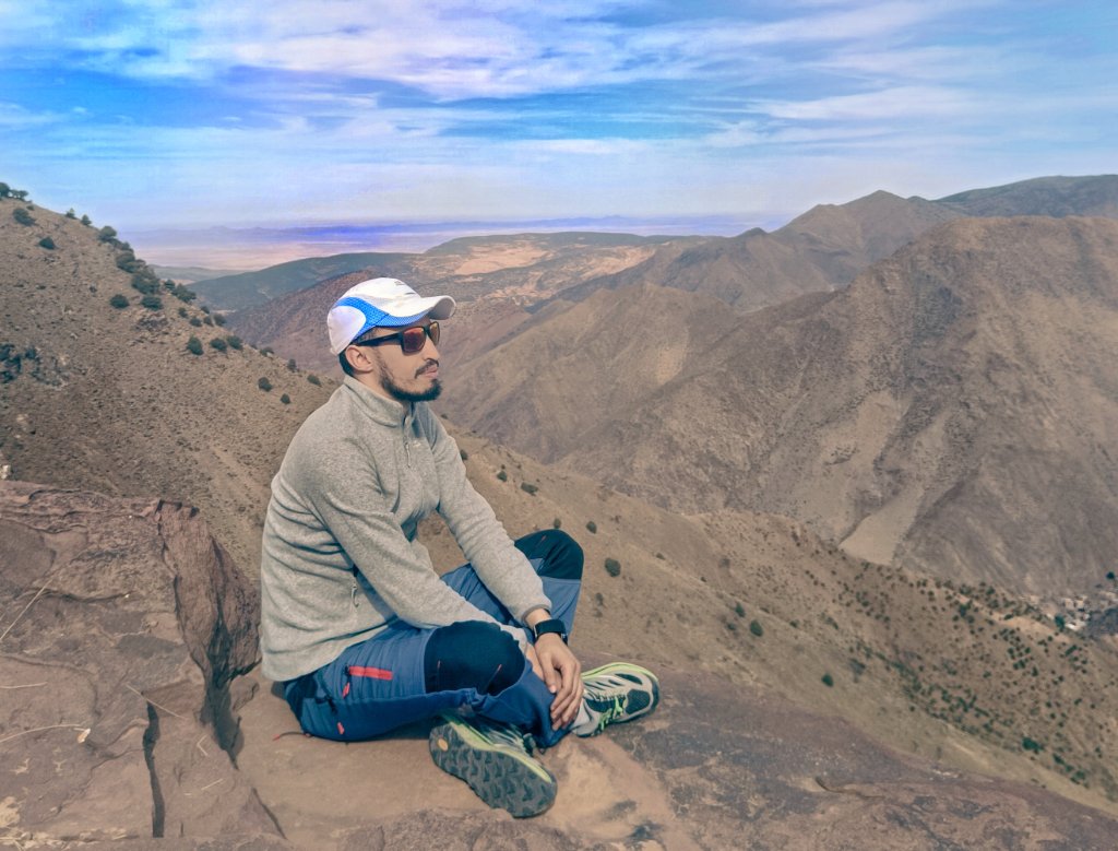
High Atlas mountain terrain above Imlil — the kind of ground the route to Tizi Mzik crosses
Tizi Mzik Hike at a Glance
| Starting point | Imlil (approx. 1,740 m) |
|---|---|
| Destination | Tizi Mzik pass (approx. 2,400 m) |
| Route type | Mountain pass hike — return for a day hike, or through-hike as part of a 2-day trek |
| Approximate elevation gain | Around 650–700 m to the pass |
| Typical walking time | A full day for the return hike — exact time depends on pace, route and conditions |
| Terrain | Mountain paths, rocky sections, uneven ground above the village zone |
| Difficulty | Moderate to challenging — a genuine mountain day requiring reasonable fitness |
| Best for | Active walkers who want a pass crossing and real altitude without a multi-day commitment |
All figures are approximate. Altitude, distance and walking time vary with the exact starting point, route variations and conditions on the day.
What Makes Tizi Mzik Different from a Summit?
The best way to understand Tizi Mzik is to understand what a mountain pass is. A summit is the highest point of a mountain — you climb it, stand on top and descend the same way or a different route. A pass is a saddle or col between two sides of a ridge — you reach it, and from it you can see down into two different valleys.
This matters for hikers because a pass gives a different kind of reward. On the way up, you are climbing toward a crossing point. At the pass, the landscape opens in two directions — back toward the Imlil valley you came from, and forward into the Azzaden Valley on the other side. You are not standing on the highest point around you; you are standing at the point where two mountain worlds meet.
For comparison, the Tasghimout summit hike is a peak at approximately 2,700 m — higher than Tizi Mzik and with full panoramic summit views. Tizi Mzik is lower but offers the pass-crossing experience, which is a different kind of mountain objective.
The Route from Imlil to Tizi Mzik
The route to Tizi Mzik leaves Imlil and follows the Aït Mizane Valley before branching toward the pass. It passes through terrain that shifts from village paths to genuine mountain ground as you gain altitude.
Imlil
Departure village · approx. 1,740 m
Aroumd
First village above Imlil · approx. 1,900 m
Aït Mizane Valley
Valley corridor climbing higher
Tizi Mzik pass
Approx. 2,400 m — the crossing point
Azzaden Valley (2-day only)
Descent into a separate valley system
Imlil to the Valley
The hike begins in Imlil and follows the same initial line used for several Imlil routes — through the lower village and toward Aroumd, the first village above Imlil in the Aït Mizane Valley. This section is shared with other routes, including the approach to Sidi Chamharouch and the Mount Toubkal trek.
Branching Toward the Pass
Beyond Aroumd, the route to Tizi Mzik diverges from the main Toubkal valley approach. Instead of continuing up the Aït Mizane Valley toward Sidi Chamharouch, it climbs toward the ridge and the pass. The terrain becomes more clearly mountainous — rockier, steeper and with less village infrastructure. This is where the hike becomes a genuine mountain walk rather than a valley trail.
At the Pass
At approximately 2,400 m, the pass itself is the objective. On a clear day, the views open in two directions — back toward the Imlil valley and forward into the Azzaden Valley. For a day hike, this is the turnaround point. For the two-day trek, the route continues down the other side into the Azzaden Valley for an overnight stay.
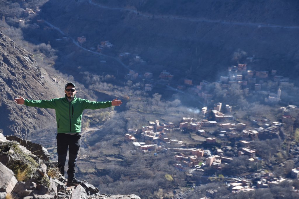
High Atlas valley views from the upper sections of the route
How Difficult Is the Tizi Mzik Hike?
The honest description is moderate to challenging. It is a full mountain day with sustained ascent to a pass at approximately 2,400 m. It is not technical climbing, but it is significantly more demanding than a village walk or the Imlil Waterfall hike.
The main challenges are:
- sustained uphill walking from the village zone to the pass
- rocky, uneven mountain terrain above the valley
- altitude gain of approximately 650–700 m
- weather exposure at the pass — wind and sun are more noticeable at 2,400 m
- the descent over the same uneven ground
For travellers who want an easier option, the Aroumd village walk or the Imlil Waterfall hike are better starting points. For those who want a higher summit objective, the Tasghimout summit at approximately 2,700 m is the stronger option.
Tizi Mzik as a Day Hike or as Part of a 2-Day Trek
Tizi Mzik can be experienced in two different ways, and the choice matters.
As a Return Day Hike
You hike from Imlil to the pass and return the same way. This is a full mountain day — there is no shortcut once you are on the route. The advantage is that no overnight stay is needed, and you return to Imlil and can continue to Marrakech the same evening.
As Part of a 2-Day Trek
The pass is also the crossing point for the classic 2-day Atlas trek: Imlil → Tizi Mzik → descent into the Azzaden Valley → overnight in a mountain gîte → return the next day. This is a completely different experience — you cross the pass rather than reaching it and turning back, and you spend a night in a remote valley. For the organised 2-day version, see our 2-Day Atlas Mountains Trek.
Best Time to Hike Tizi Mzik
Each season changes the character of the route. Mountain conditions must always be checked close to the hiking date — I will not make weather guarantees.
- Spring: generally comfortable hiking conditions, greener landscape, though weather can vary and late snow is possible at altitude.
- Summer: warmer conditions; early starts are valuable to avoid the heat of the middle of the day on the ascent.
- Autumn: often attractive hiking conditions with cooler temperatures and stable weather.
- Winter: snow, ice, cold or changing trail conditions may make the route substantially different and sometimes impractical. The pass at 2,400 m can be significantly more affected than the lower valley.
For a broader seasonal view, our guide to the best time to visit the Atlas Mountains covers the year in more detail.
What to Bring
- Hiking or trail shoes with good grip
- Comfortable walking layers
- Small backpack
- Sufficient water
- Sun protection — hat, sunglasses, sunscreen
- Light warm layer for altitude
- Windproof / waterproof shell depending on forecast
- Snacks or trail food
- Trekking poles (optional, useful on the descent)
For a fuller packing perspective, our guide to what to pack for the Toubkal trek covers mountain gear in more detail.
Do You Need a Guide for Tizi Mzik?
A licensed local mountain guide is strongly recommended. The route to Tizi Mzik is a genuine mountain trail, not a marked tourist path. Route-finding, weather reading, altitude pacing and current access conditions all benefit from local knowledge.
Access regulations and checkpoint procedures in the Toubkal area can change, so check with a local guide directly before you travel rather than relying on outdated information. For a broader discussion, see our article on whether you need a guide for Mount Toubkal.
Want to Hike Tizi Mzik with a Local Guide?
Morocco Elite Guide can arrange a private Tizi Mzik day hike from Imlil, or organise the full 2-day trek crossing the pass into the Azzaden Valley. Message Hamid directly on WhatsApp to plan the route that fits your fitness, time and season.
Frequently Asked Questions
What is Tizi Mzik?
Tizi Mzik is a mountain pass in the High Atlas above Imlil, at approximately 2,400 metres. In Amazigh and Tachelhit, 'Tizi' means a mountain pass or col. Unlike a summit, a pass is a crossing point between two valleys or two sides of a ridge — which is what makes Tizi Mzik interesting as a hiking objective.
How high is Tizi Mzik?
Approximately 2,400 metres above sea level. I would not present this as a surveyed precision value, but it is a meaningful pass elevation for a full-day hike from Imlil.
How long does the Tizi Mzik hike take?
As a return day hike from Imlil to the pass and back, allow a full day of walking. The exact time depends on pace, route, weather and stops. It is a longer and more demanding day than the Sidi Chamharouch hike because the pass sits higher.
Is the Tizi Mzik hike difficult?
It is moderate to challenging — a genuine full mountain day with sustained ascent to a pass at approximately 2,400 m. It is not technical climbing, but it requires reasonable fitness and proper hiking footwear. It is more demanding than the Aroumd village walk or the Imlil Waterfall hike.
Can you cross Tizi Mzik in one day?
Yes, as a return hike: Imlil → Tizi Mzik → return to Imlil. If you want to cross the pass and continue down into the Azzaden Valley on the other side, that is normally organised as a two-day trek with an overnight stay, not a single day.
Is Tizi Mzik on the way to Mount Toubkal?
No. Tizi Mzik is not on the standard Toubkal summit approach, which follows the Aït Mizane Valley through Aroumd and Sidi Chamharouch. Tizi Mzik is a different route — it heads toward a pass that connects to the Azzaden Valley, a separate valley system.
Do I need a guide for Tizi Mzik?
A licensed local mountain guide is strongly recommended. The route to Tizi Mzik is a genuine mountain trail, not a marked tourist path. Route-finding, weather reading, altitude pacing and current access conditions all benefit from local knowledge. Access regulations in the Toubkal area can also change, so check with a local guide before travelling.
Can beginners hike Tizi Mzik?
Fit beginners who are comfortable walking for a full day at altitude may manage it, but it is not an easy walk. If you are unsure about your fitness or have limited time, the Aroumd village walk or the Imlil Waterfall hike are better starting points.
What is the difference between Tizi Mzik and Tasghimout?
Tasghimout is a summit at approximately 2,700 m — a peak you climb and descend. Tizi Mzik is a pass at approximately 2,400 m — a col you reach and can cross. Tasghimout is higher and takes roughly 8 hours; Tizi Mzik is a full day but at a lower elevation. Both are quieter than the main Toubkal approach.
Related guides:
- → Best Hikes from Imlil: Day Hikes & Mountain Treks
- → Tasghimout Hike from Imlil: Route, Time & Difficulty
- → Sidi Chamharouch Hike from Imlil
- → Aroumd Village from Imlil
- → Aït Mizane Valley from Imlil
- → Easy Hikes from Imlil
- → Marrakech to Imlil: Distance, Transport & How to Get There
- → Best Time to Visit the Atlas Mountains
- → Do You Need a Guide for Mount Toubkal?
- → 2-Day Atlas Mountains Trek — Tizi Mzik & Azzaden Valley
- → Private Atlas Mountains Day Trip from Marrakech
- → Private Tailor-Made Morocco Experiences