Aït Mizane Valley from Imlil: Trekking Corridor & Local Guide
The Aït Mizane Valley is the main mountain corridor above Imlil — the spine of most longer walks and treks in the area. This guide explains what the valley is, how it is structured and how to choose the right section for your time and fitness.
When travellers write about hiking from Imlil, they usually name a destination — Aroumd, Sidi Chamharouch, Toubkal, the waterfall. What they often miss is that almost all of these routes follow the same valley: the Aït Mizane Valley. Understanding the valley as a whole makes it much easier to choose the right walk, because the different destinations are really different points along the same corridor.
The Aït Mizane Valley is the main mountain valley that extends above Imlil toward the higher peaks of the High Atlas. It is the natural line that the village sits at the bottom of, and it is the route that most longer walks, day hikes and multi-day treks from Imlil follow. If you walk uphill from Imlil in almost any direction that gains altitude, you are walking into the Aït Mizane Valley.
This guide explains the valley as a geographic and trekking corridor — what it is, how it is structured, what you see at different altitudes, and how to choose how far into it you want to go. For transport to the trailhead, it pairs with our Marrakech to Imlil guide.
Aït Mizane Valley at a Glance
| Location | High Atlas Mountains, above Imlil, Morocco |
|---|---|
| Starting point | Imlil (approx. 1,740 m) |
| Valley type | Mountain valley corridor — the main trekking line from Imlil toward Toubkal |
| Key villages | Imlil, Aroumd (approx. 1,900 m), and settlements along the valley |
| Key landmarks | Aroumd village, Sidi Chamharouch (approx. 2,300–2,350 m), Toubkal refuge |
| Altitude range | From approx. 1,740 m at Imlil to over 3,200 m toward the refuge |
| Walking options | Short village walks, full-day valley hikes, multi-day treks |
| Best for | Walkers and trekkers of all levels — the valley contains options from easy to challenging |
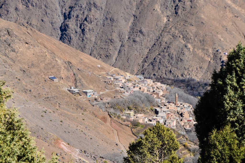
The Aït Mizane Valley above Imlil — terraced fields, villages and mountain paths
What Is the Aït Mizane Valley?
A valley is more than a path. It is a geographic corridor — a lowered strip of land between higher ground, shaped by water, settlement and agriculture over generations. The Aït Mizane Valley is the corridor that leads from Imlil upward toward the Toubkal massif. It is not a single trail or a single village; it is the landscape that contains all of them.
The name refers to the Aït Mizane, one of the Amazigh tribal communities of the High Atlas. The valley carries their name because it is the land they have lived in, farmed and shaped for centuries. The terraces you see are working agricultural land. The villages are living communities. The paths are working routes between homes, fields and water sources.
When you walk into the Aït Mizane Valley from Imlil, you are not entering a park or a staged attraction. You are walking through a working mountain landscape that happens to be one of the most accessible and rewarding hiking areas in the High Atlas.
How the Valley Is Structured
The easiest way to understand the Aït Mizane Valley is to think of it in three altitude zones. Each zone has a different character, different walking options and different difficulty levels.
Lower valley (Imlil area)
Approx. 1,740–1,900 m
Village paths, terraced fields, orchards and the first gentle climbing section. This is where short walks and easy hikes sit.
Middle valley (Aroumd to Sidi Chamharouch)
Approx. 1,900–2,350 m
The valley narrows, the terrain becomes more clearly mountainous, and the trail joins the classic Toubkal approach. This is where day hikes live.
Upper valley (above Sidi Chamharouch)
Approx. 2,350–3,200+ m
High mountain ground leading toward the Toubkal refuge and summit. This is multi-day trekking territory, not a day hike.
The Lower Valley: Easy Walks and Village Life
The lower section of the Aït Mizane Valley — from Imlil at approximately 1,740 m up to Aroumd at approximately 1,900 m — is where the easiest walking sits. This is village territory: paths between homes and fields, irrigation channels, walnut groves and terraced agriculture. The walking is gentle compared with the higher ground, and the scenery is rich in everyday mountain life rather than dramatic high-altitude terrain.
This is the right section for families, first-time visitors and anyone who wants a real mountain walk without committing to a full day or sustained climbing. The Imlil Waterfall hike and the Aroumd village walk both sit in this lower zone. For a broader list of accessible options, see our guide to easy hikes from Imlil.
The Middle Valley: Day Hikes and Mountain Trails
Above Aroumd, the valley narrows and the terrain becomes more clearly mountainous. The trail joins the classic trekking approach toward Toubkal, and the walking becomes a genuine mountain trail rather than a village path. This middle section — from Aroumd up toward Sidi Chamharouch at roughly 2,300–2,350 m — is where the strongest day hikes from Imlil sit.
The Sidi Chamharouch hike is the main day-hike objective in this section — a substantial valley walk to a traditional pilgrimage site, with sustained ascent and real mountain terrain. For a different kind of mountain day, the Tizi Mzik pass hike branches toward a mountain col at approximately 2,400 m, offering a pass-crossing experience rather than a valley walk.
For a full comparison of the hiking options in this zone, see our best hikes from Imlil guide.
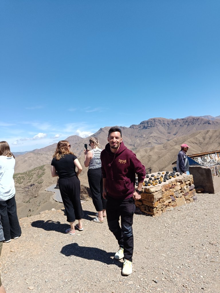
High Atlas mountain scenery in the upper Aït Mizane Valley
The Upper Valley: Multi-Day Trekking
Above Sidi Chamharouch, the valley continues toward the Toubkal refuge at roughly 3,200–3,270 m and ultimately the summit at 4,167 m. This is multi-day trekking territory, not a day hike. The altitude, the distance and the commitment required all increase substantially beyond Sidi Chamharouch.
For the full route, time, difficulty and refuge information, see our complete guide to the Mount Toubkal trek from Imlil. This article stays focused on the valley as a corridor, not as a Toubkal staging route.
Who Is the Aït Mizane Valley For?
One of the strengths of the Aït Mizane Valley is that it is not for one type of traveller. Because the valley contains options from short village walks to multi-day treks, it serves very different visitors:
- Families and first-time visitors can enjoy the lower valley without sustained climbing.
- Active walkers can take a full-day hike to Sidi Chamharouch or toward Tizi Mzik.
- Committed trekkers can continue through the valley toward the Toubkal refuge and summit.
- Travellers with limited time can do a short village walk and still experience genuine mountain scenery.
The key is choosing how far into the valley you go, not whether the valley is right for you. Almost every visitor to Imlil walks into at least the lower section of the Aït Mizane Valley.
Best Time to Walk in the Aït Mizane Valley
The valley can be visited throughout much of the year, but conditions change with altitude and season. The lower valley is walkable in more conditions than the upper valley, where snow and ice in winter can make higher routes impractical.
For a month-by-month breakdown of conditions in the Imlil area, see our Imlil weather by month guide. Never infer current conditions from a monthly average — always check the forecast before setting out.
What to Bring for Lower Valley Walks
- Comfortable walking shoes with grip
- Water
- Sun protection — hat, sunglasses, sunscreen
- A weather-appropriate layer
- Small backpack
For higher sections of the valley — toward Sidi Chamharouch and above — proper hiking footwear and additional layers are needed. For serious Toubkal gear, see our Toubkal packing list.
Walk the Aït Mizane Valley with Hamid
Morocco Elite Guide is locally based in Imlil. I can arrange a private walk into the Aït Mizane Valley adapted to your fitness, available time and season — from a short village walk to a full-day valley hike. Message me directly and I will help you choose the right section of the valley for your day.
Frequently Asked Questions
What is the Aït Mizane Valley?
The Aït Mizane Valley is the main mountain valley corridor that extends above Imlil toward the higher peaks of the High Atlas, including the direction of Mount Toubkal. It is the natural line that most longer walks and treks from Imlil follow, and it contains the villages, terraced fields and mountain paths that characterise the Imlil hiking area.
Where is the Aït Mizane Valley?
The Aït Mizane Valley begins above Imlil in the High Atlas Mountains of Morocco. Imlil sits at approximately 1,740 metres, and the valley climbs from there toward higher mountain ground, with villages like Aroumd at roughly 1,900 metres and Sidi Chamharouch at roughly 2,300–2,350 metres along its line.
Can you walk in the Aït Mizane Valley?
Yes. Walking in the valley ranges from short village walks near Imlil to full-day hikes toward Sidi Chamharouch and multi-day treks toward Mount Toubkal. The valley is not a single trail — it is a corridor containing multiple routes, villages and walking options of different lengths and difficulties.
How far can you walk into the Aït Mizane Valley?
It depends on your time and fitness. A short walk can reach Aroumd at roughly 1,900 m in about 40–60 minutes from central Imlil. A longer day hike can reach Sidi Chamharouch at roughly 2,300–2,350 m. A multi-day trek can continue through the valley toward the Toubkal refuge and summit at 4,167 m.
Is the Aït Mizane Valley the same as Imlil Valley?
Imlil sits within the lower part of the Aït Mizane Valley system. The names are sometimes used loosely, but 'Aït Mizane Valley' more specifically refers to the mountain valley corridor above Imlil that leads toward the higher peaks, while 'Imlil' usually refers to the village itself and the immediate surrounding area.
What villages are in the Aït Mizane Valley?
Aroumd (also written Armed or Aremd) at approximately 1,900 metres is the best-known village in the valley above Imlil. Other settlements and hamlets exist along the valley, and the walking route passes through or near several of them before the landscape becomes more clearly mountainous above Aroumd.
Do you need a guide for the Aït Mizane Valley?
For a simple walk around Imlil and the lower valley, experienced independent walkers may find their way. For anything beyond the immediate village area — longer routes, higher ground, or connections to Sidi Chamharouch and Toubkal — a licensed local mountain guide is strongly recommended. Access regulations in the Toubkal area can also change, so check with a local guide before travelling.
Is the Aït Mizane Valley suitable for families?
The lower valley — short walks around Imlil and toward Aroumd — can work for families who are comfortable on uneven mountain paths. Higher sections toward Sidi Chamharouch involve sustained ascent and rocky terrain that may not suit every child. Route choice matters, and a flexible plan is better than a fixed objective.
What is the altitude in the Aït Mizane Valley?
The valley starts at approximately 1,740 metres at Imlil and climbs steadily. Aroumd sits at roughly 1,900 metres, Sidi Chamharouch at roughly 2,300–2,350 metres, and the Toubkal refuge at roughly 3,200–3,270 metres. The altitude you experience depends entirely on how far into the valley you walk.
Related guides:
- → Best Hikes from Imlil: Day Hikes & Mountain Treks
- → Easy Hikes from Imlil
- → Aroumd Village from Imlil
- → Imlil Waterfall Hike
- → Sidi Chamharouch Hike from Imlil
- → Tizi Mzik Hike from Imlil
- → Mount Toubkal Trek from Imlil
- → Marrakech to Imlil: Distance, Transport & How to Get There
- → Imlil Weather by Month
- → Where to Stay in Imlil
- → Private Atlas Mountains Day Trip from Marrakech
- → Small Group Atlas Mountains Day Trip